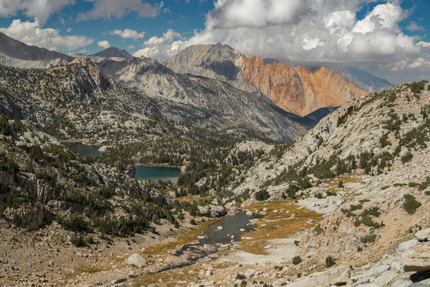
The Eastern Sierra High Route is the premiere advanced backpacking adventure to be had in California's Sierra Nevada in about a week or less. It is 65-70 hard miles, 70-80% off-trail, from Mammoth (Duck Pass Trailhead) to Bishop (Bishop Pass Trailhead at South Lake), staying as close to the main Sierra crest as possible without becoming technical and using as little trail as possible. These parameters highlight the unique characteristics of the Eastern Sierra, in particular striking desert-to-mountain transition views.
IMPORTANT: The Eastern Sierra High Route should be viewed as a ‘step-up’ route from something like the Sierra High Route. It is shorter but more intense. While there is nothing on the ESHR that is above class 3 or terribly exposed, the route is consistently difficult for most of its distance. In particular, it features consistent sections of steep and occasionally loose talus, scree, and sand. The route features 13 cross-country passes, some of which are quite challenging.
By purchasing this guide, you acknowledge that backcountry travel and routes like the ESHR carry inherent risk such as rockfall, inclement weather, and remote locations, and you assume all such risk involved in attempting the ESHR with the use of these guide materials.
Is the ESHR for you?
Someone attempting the ESHR should, at a minimum, have completed one of the following: Sierra High Route, Southern Sierra High Route, Yosemite High Route, Kings Canyon High Basin Route, or Wind River High Route (Skurka version). If you felt comfortable on any of those routes, you should have fun on the ESHR.
While I am including section hikes intended to increase the approachability of the ESHR, any adventure on this route is meant to be a challenge.
This guide includes the following (7) download items:
- 'Start here' preliminary information
- Trip Planning & Logistics Document
- Field Guide (critical beta for every step of the way)
- Recommended Section Hikes
- 11x17 printable mapset with detailed waypoints
- Detailed waypoints in JSON format
- Datasheet
About the Field Guide
This is the most valuable item in this download package. Its beta and route descriptions are highly detailed and will greatly increase the efficiency of anyone attempting the route.
About the mapset
This is a 10-page PDF intended to be printed on 11x17 paper (easy to do at FedEx, Staples, etc). 8.5x11 is too small. These maps were created in CalTopo with the USGS 7.5 Minute Quads as the basemap and include breadcrumb waypoints and relevant terrain notes.
About the waypoints
These are intended to be imported to CalTopo, which is where they were created. They should work fine in other apps but I haven't tested them in any besides CalTopo.
About the section hikes
There are 5 recommended section hikes in the guide varying in difficulty. They range from 23 to 35 miles and the easier ones are intended for intermediate off-trail hikers who are not yet ready for the more intense sections of the ESHR.